Industries
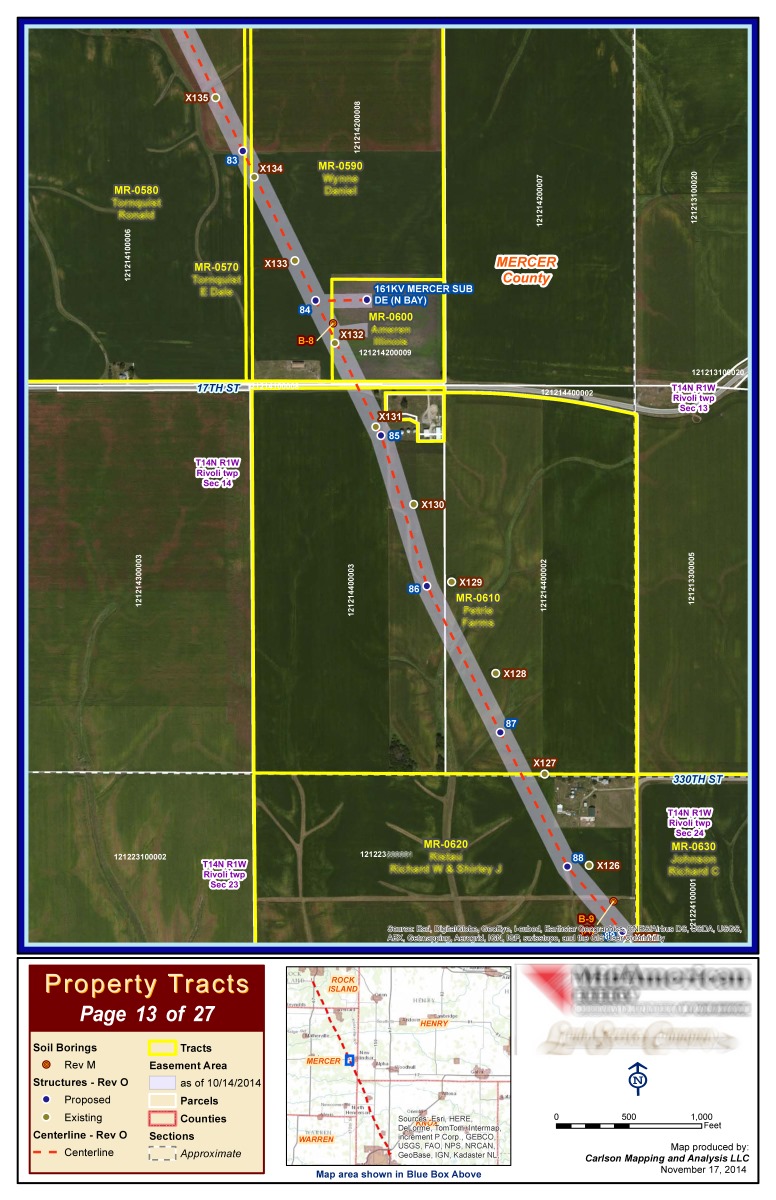
Land Service Agencies
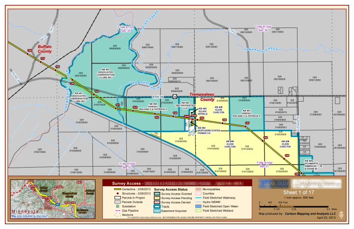
GIS is an invaluable tool for monitoring land rights acquisition projects. From regulators, to utilities, to project managers, engineers, field agents and land owners, everyone can be kept informed on the latest developments.

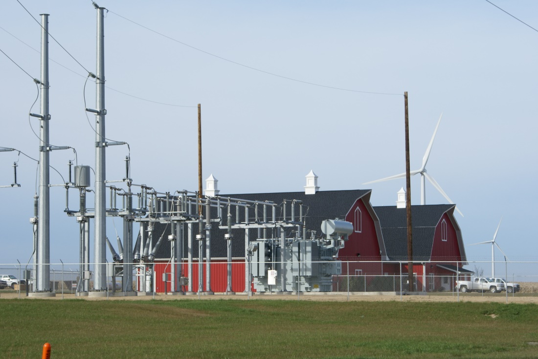
Utilities
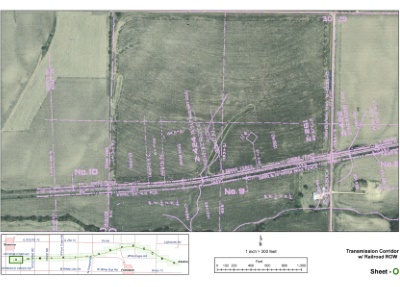
GIS is part of a ‘Best Practices’ management program for designing, maintaining or upgrading your utility infrastructure. Whether its electrical power, natural gas pipelines or water utilities, GIS offers an invaluable tool for visualizing your system. See the location, condition and design details of any part of your network exactly how you need them.

Wind Farm Developers
GIS allows you to build wind farms that are productive, cost effective and socially and environmentally responsible. Powerful database tools allow you to analyze and manage your site in real time. With GIS, you visualize your decision making.
Municipalities
Modernize your existing paper or CAD infrastructure drawings into GIS for easy mapping and system analysis. Keep everyone from the field crews to management informed on materials, dimensions, condition and age of any feature you choose.
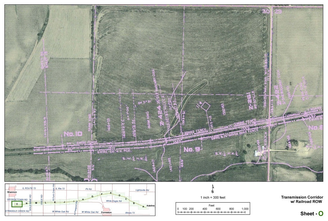
Engineers
Rather than maintaining staff with GIS training and all the attendant software, hardware and data requirements, consider using a GIS specialist. We have a great deal of experience importing and exporting CAD drawings into GIS data for mapping, database work or spatial analysis.
We help you meet your client needs and offer affordable subcontractor rates.
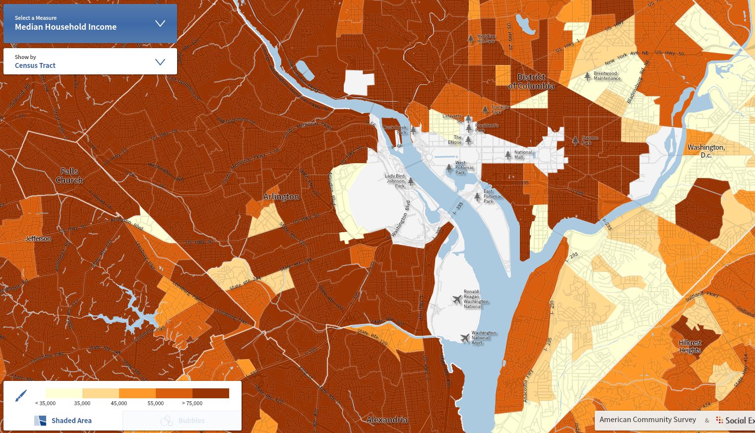
Business
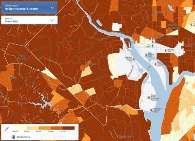
See where your customers are, your competition, demographic areas and trends. The applications of GIS for the business community is endless, invaluable and largely underutilized.